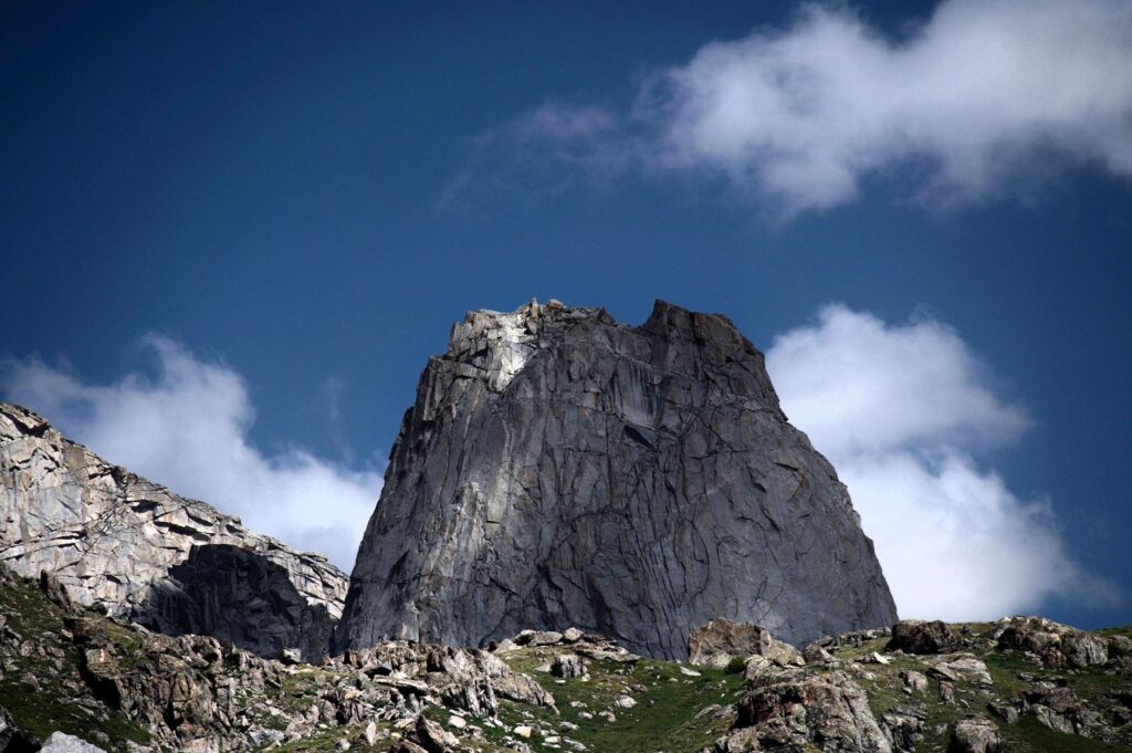
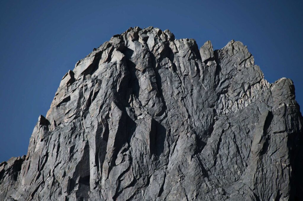
Moonlit granite flashed like polished steel when I first crested Dickinson Park, and for a breath I thought the whole wind river range might lift and drift away on the night air. I came to chase spires; I stayed because silence roared louder than any summit.
Granite Echoes & Growing Confidence
This corner of the wind river mountain range runs roughly 100 miles north–south and hosts Wyoming’s loftiest non‑Tetons, yet it still feels secret—a back‑country built for walkers who relish earning their views.
July through mid‑September offers the driest footing and the least snow on passes, best time for backpacking in the wind river range wyoming, though black clouds can still bruise the horizon by noon.
As miles slid under my boots, I realised every valley here rewards patience: go unhurried, and the granite opens like a book you read with your own feet.
“We came for the granite spires and stayed for the silence.”
Silas Canyon — A Hike for All Ages
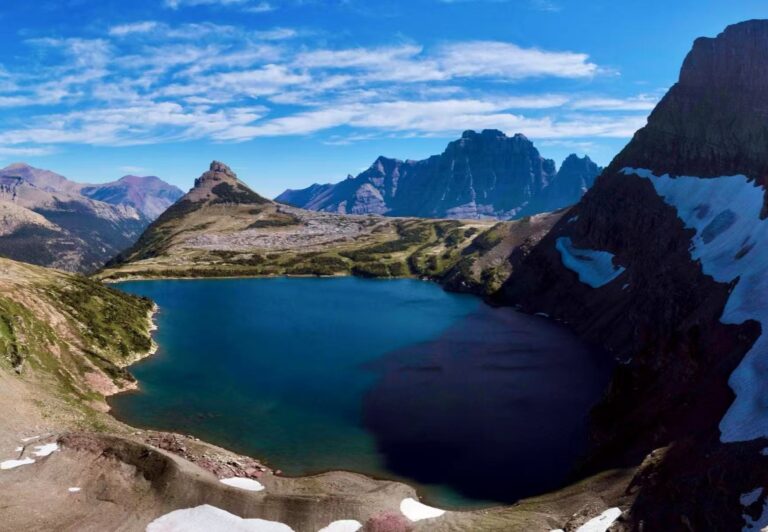
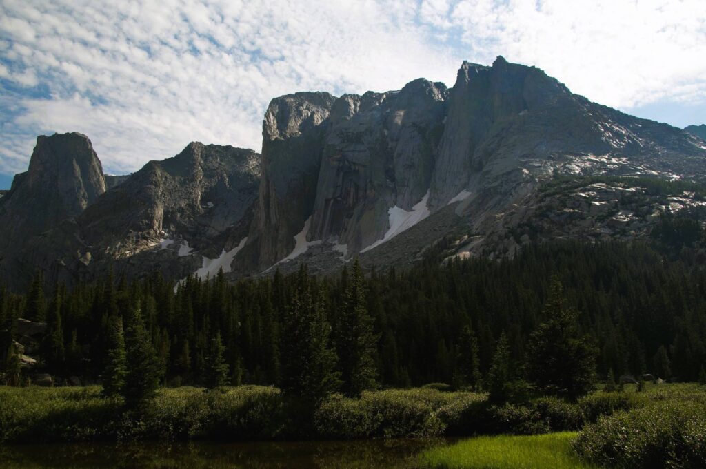
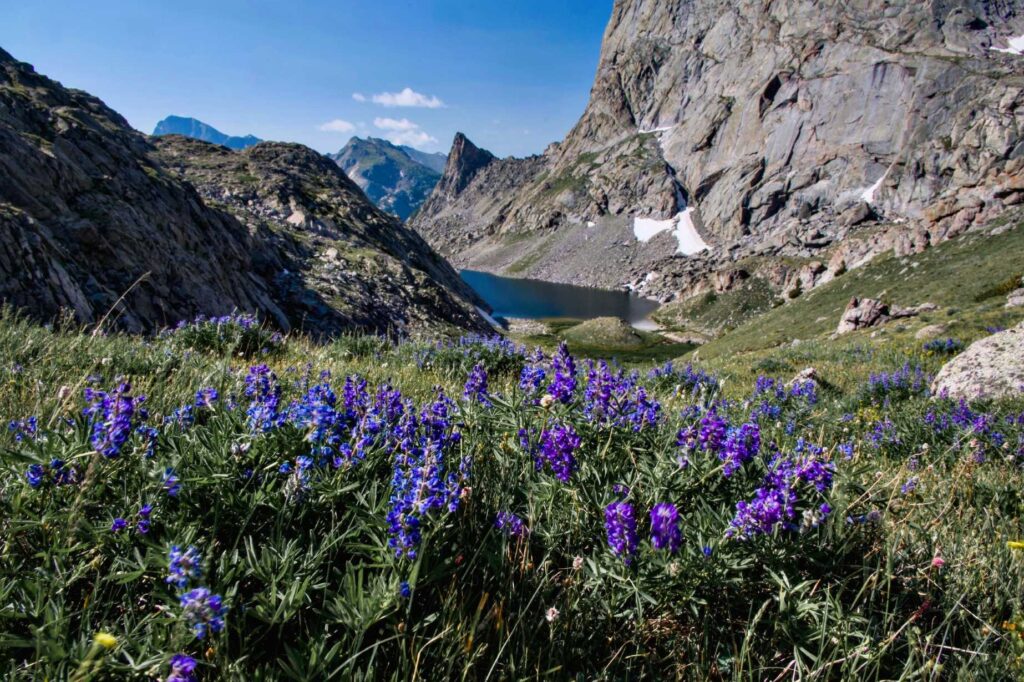
By 7 a.m. the wind river range sky blushed rose behind Fiddlers Lake, and my breath already smelled of spruce. The trail slipped into shadowed woods where chickadees chirped like alarm clocks set for wanderers. Scalloped granite feels intimate, hiking here felt like paging through memories only mountains keep. Lupine shook in a breeze that smelled of wet stone and pine sap.
Yet, around each bend the walls steepened just enough to remind me the wind river range in wyoming never hands out vistas for free. I lingered at the saddle just long enough to feel small and lucky, thenI keep going, my knees reminding me that descents count too. With kids in tow you could stop right here and call it magic, yet the valley keeps sweetening if you push on.
The path leaves the Christina Lake Trail 1.8 mi from the lot, then bends northwest into Silas Canyon inside the Popo Agie Wilderness. Lower to Upper Silas Lake is roughly 7.1 mi round trip with 900‑1,200 ft of steady gain—moderate for most hikers. No permits are needed, store food 100 ft from water because black bears roam the drainage.
By noon I reached Island Lake and watched clouds swirl like spilled milk over the ridge. Shadow stripes raced the water, erasing and repainting the peaks every heartbeat. A pair of teenagers cannonballed from a granite shelf—proof that Silas really is “a hike for all ages.” I napped against a sun‑warmed boulder, woke to dragonflies patrolling a mosquito flotilla, and realized half a day here fills the soul more than a week of screens. On the return I tucked a flat rock into my pocket: tactile memory of lake‑still calm.
Some Trail facts
- Distance 7.1 mi round‑trip to upper Silas Lake.
- Difficulty Moderate: 900 ft gain, sturdy footing, campsite‑rich benches.
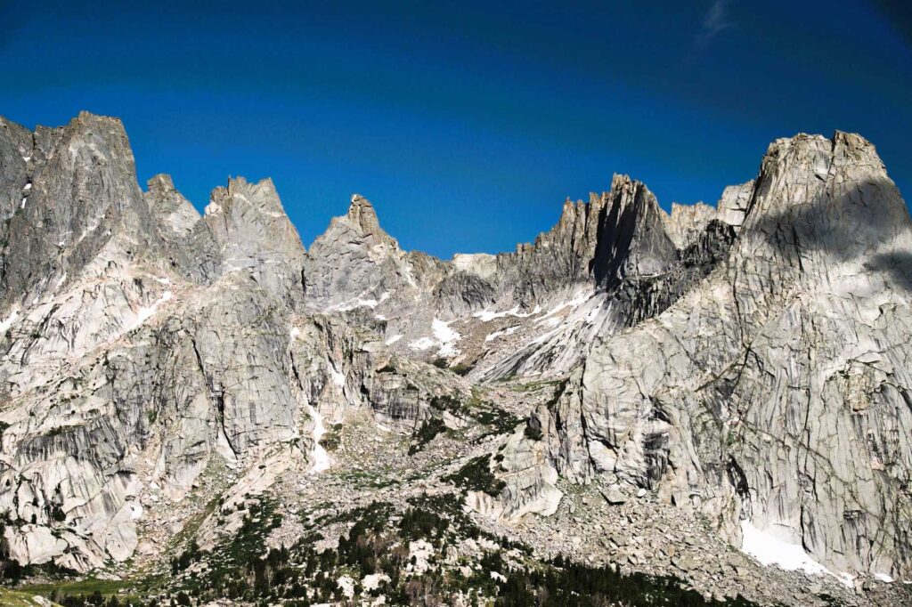
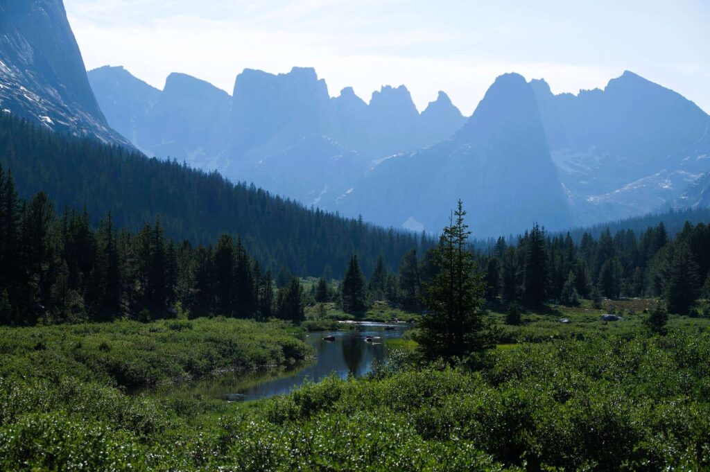
Cirque of the Towers — Cathedral of the Winds
The Cirque sits in the southern wind river mountain range, a granite amphitheater chiselled by Pleistocene ice and framed by spires like Pingora and Wolf’s Head. Its reputation draws climbers worldwide, yet the 25‑mi backpacking loop from Big Sandy still feels wildly remote to anyone lacing boots for the first time.
By 9 a.m. I crested Jackass Pass, heart hammering, and the entire Cirque exploded into view—stone fingers pointing at a cloudless Wyoming sky. on Texas Pass felt like standing on a balcony above my own smallness. Geological drama fuels the scenery: 2.7‑billion‑year‑old gneiss uplifted during the Laramide orogeny, then polished by Bull Lake and Pinedale glaciers.
Trail facts
- Loop 25 mi, 4,100 ft gain; typical 3‑day circuit. (More trail detail)
- Camping First‑come sites around Shadow and Lonesome Lakes; practice strict bear‑proof food storage.
- Season Mid‑July through early September; expect patchy snow on passes earlier.
- No permits are required to backpack, camp, or climb in this section of the wind river range
- Mosquitoes peak in July—head‑nets and picaridin rescue sanity.
What to Notice for the Wind River Range
- Roads can wash out after thunderstorms—carry a spare and check local ranger updates.
- Some trail are 50 miles from the nearest town, so be sure to have a full tank of gas and good tires
- Cell service drops after 10 miles; tell someone your plan.
- A good hiking map and a compass are valuable instruments in the backcountry and a guidebook is highly recommended.
- Pets are allowed
- Best weather window: late July–late August (fewer mosquitoes, steadier rock).
Three Fast Acclimation Tricks
- Sleep low, climb high: keep nightly camp no more than 1,000 ft above the previous night once you pass 10,000 ft.
- Hydrate early, add electrolytes: thin air dries lungs fast; start sipping before thirst.
- Bake in rest hours: a midday hammock break beats powering through fatigue; two naps beat one summit.
Gear Checklist
- Navigation – topo map + offline GPX.
Backpack – use lightweight, comfortable, convernient backpack during hiking.
- Hiking Poles – We used Carbon Hiking Poles on this trip. They are lightweight and strong. The inherent shock absorption of carbon fiber further dampens vibrations, which helps minimize stress on joints.
- Cooking kit – 1 – 2 L pot & canister stove; switch to alcohol stove if going ultralight.
- Water treatment – filter + backup tabs.
- Bear storage – canister (required) or Ursack; carbon‑fiber can saves 8 oz.
- First aid/repair – blister kit, tape, multitool.
- Optional ultralight upgrades – Dyneema pack liner, fleece beanie, titanium spoon.
Closing Steps on Ancient Stone
The moon rose a second time before I left, silvering cairns and turning spruce into silhouettes. I packed out more clarity than miles and caught myself whispering a promise: I’ll be back to try wind river range backpacking routes I haven’t even dreamt of.
If you’re eyeing backpacking in the wind river range wyoming, remember—confidence grows over granite steps. The trail will test you, yet it gifts twice what it asks. Short days, deep breaths, bold nights: that’s backpacking wyoming wind river range style.
If you want to explore more, try the “Circle the Continental Divide” road trip. It is one of the top ten scenic drives in the Northern Rockies.
You can start in Jackson and drive past Grand Teton National Park, Yellowstone National Park, Cody, and Wyoming’s Wind River area.
No matter if you begin in Denver, Salt Lake City, Las Vegas, Billings, or another city, this trip can easily become part of your travel plan.
Before you step away from the office, get some free time, and prepare for a hiking outside, one important question will come to mind:
- What to wear hiking?
- What hiking boots to wear?
- What jacket to wear?
- What sunglasses to wear?
Not only will the right equipment make you more comfortable, but you’ll also enjoy hiking more. Let’s simplify it by getting down to the basics: layering, footwear, and accessories.